Tuesday, October 30, 2012

Sandy (Part 2)

Back aboard, we and the boat are chilly but ok.

Wind gust of 90 reported last night at Bay Bridge. Storm center (not an "eye" because it wasn't officially a hurricane when it came ashore and mixed with the cold front according to NWS) stalled over Baltimore area last night at midnight - we noticed an eerie drop in wind speed around that time before it abruptly started up again.  Had we been aboard, we would have watched the low pressure peg the dial on our barometer (938 mb?)

Water here at our marina is to the stringers but not over the docks; or about 2-3 ft above normal. No major casualties; a couple of shredded biminis. . Taking the day off to rest, recover, and process the storm. And to raise a glass to all who were on duty during the storm yesterday - Navy, Coast Guard, LEOs, ... and our excellent marina staff.

Monday, October 29, 2012

Sandy! (part 1)


We've stayed aboard for 3 other hurricanes - Lenny (St Thomas), Isabel and Irene (Annapolis). But this Sandy scares us. Not so much it's strength, done that before, but the immense size = long duration. We took ALL the canvas off Cinderella and tied her with 14 docklines. She's centered in the middle of that giant slip we live in; we almost needed to use the dinghy to exit.  The slip is ridiculuously overbuilt - 33 foot boat in a 50 foot slip, plenty of room to rattle around in, and 8, 8-foot pilings.


 We left about 5 PM yesterday, and are hanging out in our marina's lounge. With its leather sofas, flat-screen TV and microwave, etc, we have all the comforts of home. More comforts than home, actually, we don't even have those things on the boat. Plus, we're on the second story, no flooding, no trees around to fall on us, and a good view of the creek. Met up with friend Dave last night, he's riding it out on one of the city's hurricane moorings, and had pizza.

Mostly I was surprised at the quiet during the evening and overnight, compared to the sounds of the wind whistling in the rigging when we left, it's nearly silent here, and it doesn't rock. Got coffee for the morning, granola and boxed milk and canned tuna and snacks, and rum. Lots of rum.


Saturday, October 13, 2012

A Bit of Public Speaking

(Image from http://www.pivotalpublicspeaking.com)
There’s an oft-quoted statistic in business and self-help books that says it is very common to have a deep fear of public speaking. I was most definitely born without that gene. What can I tell you? I’m a Leo, and if you study astrology it claims that Leos like being the center of attention. So when a friend asked if we would please please please consider hosting a session on resources for cruisers traveling the ICW, I secretly considered it an opportunity to accomplish several things with a single act. (“Two birds with one stone,” and all that, but I hate that analogy, since dead birds just don’t make me happy.) We could pass on to other cruisers the wonderful mentoring that we had received from James and Ellen before our first trip, and … we could get the requester in our debt for doing something that was really not very unpleasant at all. Never know when this might come in handy if we need a favor in return.  Ooops, now that I’ve admitted that publicly, I guess I’ve rather ruined the impact. Sigh. I know said requester reads this blog.

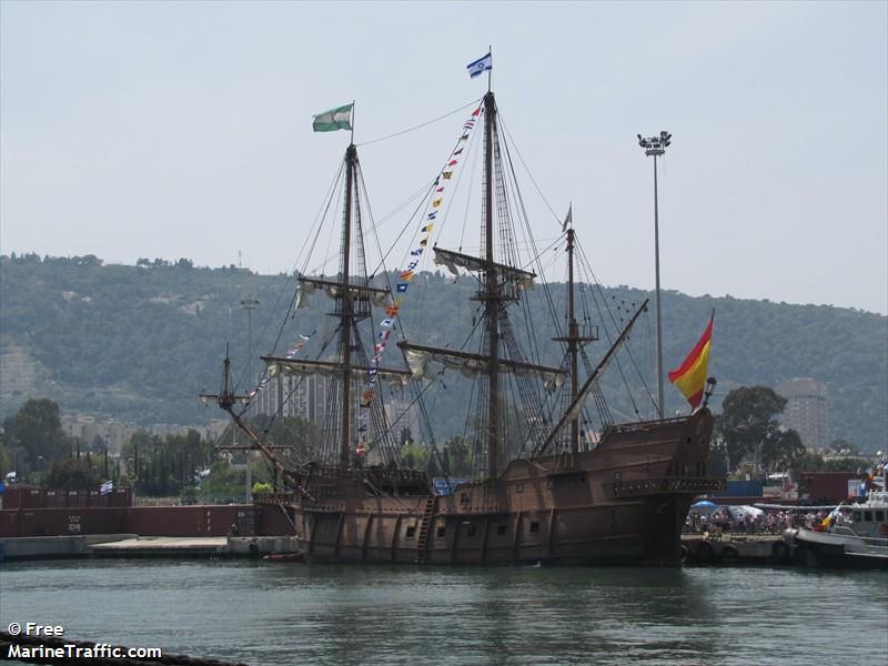
Anyway, I need to back up a bit. On September 19, “Talk Like A Pirate Day,” we put on our pirate garb and went to the Eastport/Annapolis Neck library where we entertained the kids for their pirate-themed event. (pix on the library’s Facebook page; one even appeared here in the Capital next day.) “Remember,” we warned the kids, “we’re just playing here. Real pirates are bad guys, okay?” But I don’t really have a lot of qualms about being perceived as glorifying the bad guys. I learned from other historical-reenactor friends, you meet the kids where they are. Do what it takes to get their attention, get them hooked on history, and then use that as a springboard for the messages you really want to deliver.

“Library? What good is a library to a pirate?” I asked the kids. “Most pirates can’t read, because they think the first letter of the alphabet is “aaargh,” I joked with them. (Kinda corny, I know, but it plays pretty well to 5-year-olds.) “Though pirates do not be needing a library, the library needs pirates,” my friend Beth, wise mother of a challenging 4-year-old, responded later. “For children of all ages need inspiration to sail out into the unknown and find adventure. Many a true tale was inspired by Treasure Island.”

And just over a week after that, we gave a presentation about resources for traveling the ICW from Norfolk, Virginia to Florida to some grownups who may once have been those inspired children of whom my friend Beth spoke. I’m not much of a “joiner” of organizations or yacht clubs, etc; we generally tend to go our own way and associate if anything more with other locals than other cruisers. If we didn’t value independence, after all, we wouldn’t be traveling on a sailboat. One cruising organization we did join, however, was Seven Seas Cruising Association. It’s an organization of cruisers helping cruisers with everything from advice to rides to the grocery store.

We had sailed down to the Rhode River for the SSCA gam the weekend preceding the boat show. (A “gam” is a social visit or friendly interchange, especially between sailors or seafarers) where we met many friends old and new, and others we’d typed with for months or years online and had never met in person. There were 60 or 70 anchored boats arriving for the event, and more people who drove in, almost 500 attendees in all. Being me, I stressed mightily before the presentation, but enjoyed it while interacting with folks, and overall it seemed very well-received. Of course, the fact that we’d been up until 2 AM the night before, chatting under the stars (“gamming” indeed) and sipping rum with Melissa and Anne and Donna and John might have had something to do with that stress…

Giving the presentation got us chatting with a lot of interesting folks and certainly contributed to the fun we had overall at the event. And, as is often the case, the best way to really learn something is to try and teach it. In preparing for our presentation, in pulling the resources together, reviewing guidebooks and websites and apps and charts and finding out what tools are out there, we learned a lot that will probably make our own next ICW trip even richer and more rewarding – and hopefully, even more comfortable.
 
= = = =
I've posted a summary of the presentation that includes links to the websites and other resources. I’m trying to crowdsource this, so if you have favorite websites, guidebooks or apps that aren’t on my list please tell me a bit about them in the comments.

Life Afloat is also on Facebook!

Sources of Information for the ICW Trip

Here is the handout from the presentation we did at the SSCA gam last month, on resources for making the trip down the ICW from Norfolk, VA to FL.  We had a table filled with maps and books and nautical charts in various formats from various publishers, and screen shots of websites and apps.  This probably worked a lot better at the live presentation, where folks could see and touch the charts and guidebooks, but at least, here are links to the websites and other resources that are available to help you make the trip.
 = = = =


Paper Charts
   

Maptech Regions 6 and 7 (these are the big 17 x 22 charts organized like a AAA trip-tych, cost around $120 each)

Inlet Chart Book by Steve Dodge (These are the major ocean inlets back into the ICW, not the ICW itself. book size about 8-1/2 x 11; about $20)

ICW Chart Book by John and Leslie Kettlewell (spiral bound, book size about 8-1/2 x 11; same scale as the Maptech charts but smaller so they show less of the surrounding area; about $60. 6th edition is out now)


Guide Books (those marked with an asterisk are SSCA supporters)


*Doziers Waterway Guides: http://www.waterwayguide.com/publications.php?area=about_guide (great info for going ashore, what to see/do in town, marina ads, aerial photos)

*Skipper Bob's Anchorages: http://www.skipperbob.net/publications (very simple text-only summary of anchorages, free docks, and bridge info)

*Managing the Waterway: http://www.onthewaterchartguides.com/guides-books/icw-detail (I describe this as a "piloting" guide. For each section of the waterway, all the info about shoals, anchorages, marinas, bridges, WX channels for VHF, phone numbers for bridges, and text tidbits about local history, wildlife, culture are on each 2-page spread.)

*Anchor Guide for the ICW: http://www.onthewaterchartguides.com/guides-books/icw-anchorguides (This is the book with the small charts for each anchorage including depth soundings, direction of best wind protection, and many other details.)

The Great Book of Anchorages: http://www.tgboa.com/

Maptech's Embassy Cruising Guides: http://www.richardsonscharts.com/product_detail.php?id=11


Websites
Guides
The first 3 - Active Captain, Cruiser's Net, and Dozier's, all three have info on shoals, problem areas, anchorages, and marinas, so use whichever works best for you.  I review all three when planning our navigation for an area, but find that the greatest strengths of each are different.
Active Captain: https://activecaptain.com/ (crowdsourced; my first choice for finding a good boatyard wherever we happen to be)
Cruiser’s Net: http://cruisersnet.net/ (professionally reviewed; my first choice for finding out about shoals and problem areas)
Dozier’s Waterway Guide: http://www.waterwayguide.com/ (professionally reviewed; my first choice for local news)
U.S. Army Corps of Engineers: http://www.saw.usace.army.mil/nav/ (This is the North Carolina district; has links to other regions.  Note that the Corps refers to the ICW as the AIWW - Atlantic Intracoastal WaterWay)
U.S. Coast Guard Local Notice to Mariners: http://www.navcen.uscg.gov/?pageName=lnmDistrict&region=5

Weather

Accuweather: http://www.accuweather.com/ (different weather analysis than NOAA)
NOAA: http://www.weather.gov/ (no ads; you’ve already paid for this service with your taxes)

The Weather Channel: http://www.weather.com/ (their ipad app has a nice layout)
Weather Underground: http://classic.wunderground.com/ (loads faster than new version; this is just repackaged NOAA data, some people prefer this format)

Wind

PassageWeather: http://www.passageweather.com/ (wind strength map like a grib file, looks forward about 6 days)
(and many many more, but don’t forget WX on your VHF!)

Tides

Apps
  (The first seven are ones I use, the rest were suggested by attendees)

Charts and Tides (Navimatics, about $25 at the iTunes store - turns your phone into a chartplotter, and links to active captain website)

RadarScope (shows which way storm cells are moving, about $10)

Sky View (names constellations, stars and planets, $2)

Drag Queen (anchor watch; free)

iAIS (gives AIS info if you're in cell phone range; free)

BoatUS and SeaTow both have apps (free)

NOAA, WeatherUnderground, etc, have apps (free)

most of the online forums such as Sailnet, Cruiser's Forum, etc all have apps

Smart Buoys (for those 8 - 10 big yellow informational buoys in the Chesapeake Bay)

Compass i

Theodolite

eSeaChart

Tide Graph

Wind Alert

Radar Now (Android)

 Forums

(and many many more)

SSB Radio Nets

Radio Nets: http://www.docksideradio.com/east_coast.htm (if you have an SSB, this website lists all the cruisers nets, time and frequency to listen in)

= = = =
I'm trying to crowdsource this presentation -- if you have other good websites or apps, please tell me about them in the comments.

Life Afloat is also on Facebook!  http://www.facebook.com/pages/Life-Afloat/211190278933810

Wednesday, October 10, 2012

Raft Up: Fear


A bolt of lightning = a bolt of fear for me
My grandmother was a fearful person and famous in our family for worrying.  If we were late arriving for a visit, the cause wasn’t simply that we were delayed in traffic.  Undoubtedly we had gotten into a serious wreck, or gotten lost in a dangerous area of town and been attacked, or (who knows?) washed away in a flood or struck by lightning or eaten by dinosaurs.  She gets a by on this fear: there are family stories about how she was smuggled across WWI Europe as a nubile teenager, along with her brothers and sister.  I don’t doubt that the things she saw and experienced in those days earned her the right to nightmares.

My mother, therefore, grew up with a mother who was always, always, looking over her shoulder and imagining that bad things had happened/were happening/were about to happen to her family.  So, growing up with that kind of discomfort, no matter how much she worried about her kids’ safety when we ran around exploring, she swallowed her own fears, put on a brave face, and did her best to make sure that my brother and I grew up with a healthy respect for the world, but without being saddled with that kind of phobia.  Her sacrifice worked extremely well; when we first moved aboard and started voyaging, I had, perhaps, rational concern for the power of nature, and concern about the logistics of being far from home, but no fears about our new lifestyle.

Ah, innocence that did not last long!  I did not remain a fearless WonderWoman sailor.  So here’s the catch.  I was also the kind of kid who only had to touch the hot stove exactly once to learn caution.  As kids, we could explore our world, try just about anything, imagine scenarios and how we’d act in them, make mistakes and learn from them.  The only thing that wasn’t okay with our parents was to make the same mistake twice.

I loved watching the terrible beauty of thunderstorms when we lived in Colorado, what my friend Nancy called the “land of passionate weather” – no gentle misting rain here, but blizzards in winter and thunder in summer.  But we lived in a sturdy old house on the plains, and any bad weather looks better from the vantage point of a sofa and viewed through a pane of glass!

My first thunder-and-lightning storm at sea was indeed terrible beauty:  it was July 4 and the Independence Day fireworks displays were puny compared to Mother Nature’s.  Lightning crackled 360 degrees around us (somehow, magically, we weren’t hit) and tossed shimmering phosphorescent green water around us and over the bow.  I wasn’t scared during the event, but was awed.

My second big thunderstorm experience occurred at anchor in North Carolina on what was supposed to be a peaceful night, and it’s the one that really changed my outlook.  It was one of only two times that our anchor failed to hold as lightning crashed around us and a tornado or microburst pushed us into the shallows.  (The only other time our anchor dragged was also in a thunderstorm, do you see a pattern here?)  Dan processed that storm as one of many things in life that you cannot do much about, so just have to deal with when it happens.  For me, though, that storm was my hot-stove moment, some kind of nautical PTSD.  I’m just too acutely aware, now, of how small our boat really is, and how we’re sitting right at the bottom of a lightning rod disguised as a mast, and how strong the winds can be. It’s not a crippling phobia, I don’t shiver under the bunk the way our dog did during storms or fireworks, but still, I seem to react disproportionately.  Years later, and as little as a 20% or 30% chance of storms in the forecast is enough to get me going.  When gray clouds start to build, I (as chief navigator and weather forecaster of Team Cinderella) will take us miles out of the way to a secure anchorage or marina, where we can both observe the storm as I prefer – through a pane of glass.


Click on the monkey's fist to read others bloggers on this topic.
The Monkey's Fist

Sunday, October 7, 2012

How to Make a Month Fly By


Yikes!  Can it really have been an entire MONTH since I’ve blogged?  While we were on the hard this summer, waiting for the boat to dry so we could put on the new copper bottom paint, time seemed to just crawl by.  Summer days are long, of course, but this was something else.  Time just dragged.  Finally, after being out of the water for the oddly symmetric dates of 7/9 through 9/7, the job was complete and we were back afloat where we belong.  And the clock, which had been ticking so … very … slowly … day … by … day, now speeded up and time passed-in-a-breathless-blur-of-friends-and-events.  Every one of them reminds me of how lucky I feel to have this life and the opportunities and connections it generates.

Even the sunset in Whitehall Bay was copper-colored!
We celebrated the completion of the Coppercoat paint job by hosting a “copper” themed party that Saturday after we splashed: Fordham “Copperhead” Ale to drink in shimmery orange cups; a variety of appropriately-colored food served on russet-hued plates (golden curries, pumpkin, and butternut squash featured prominently); shiny copper mardi gras beads for folks to wear; I was even dressed in the slinky shiny bronze pants I wear for fun evenings out.  The day before, we had taken the boat to anchor out overnight at Whitehall Bay just to clear our heads.  We sailed gloriously FAST – don’t know whether it was the chemistry of the new paint or the meticulous job our marina did with the fairing and application, or both – but it was delightful!  Even the sunset that night was copper-colored, as if the Chesapeake was celebrating with us and welcoming us back.

There came throughout September and into October a series of big events worthy of separate posts, and smaller meetings and trips and parties with a swirl of friends.  Christmas may be the most wonderful time of the year according to the carol, but religious implications aside, my vote for most wonderful time of the year goes to boat show season in Annapolis.  The days are still warm and the nights are cool and the winds are a bit stronger for sailing.  It’s the time when people who spent the summer in Maine or Canada to escape the heat (and potential hurricanes) are passing through Annapolis on their way southbound to warmer climes.  Boat Show time in Annapolis!!! Don't know what I love more, seeing all the shiny new boats and gear, or seeing all the friends old and new who come to town for the show.  Yes, I do know.  What’s best of all is getting both: friends Tony and Michelle from St Augustine were here with their new boat A La Mer (To The Sea) which appeared, beautifully decorated and staged, in the show.  

= = = =

Thanx go to reader “Paul” who commented on my last post about COLREGs for everyday interpersonal interactions that technically, the rules we refer to as COLREGs apply in international waters.  The collision that sparked my post occurred in the Magothy, so inland, not international, navigation rules would apply.  When I first pitched the idea of this blog to the Capital-Gazette, I billed it as a sailing blog for non-sailors, to help people understand this nautical obsession that is so much a part of Annapolis culture.  I didn’t think our adventures were quite bold enough to interest serious sailors, we’re not crossing oceans, after all.  Sometimes, especially in stormy weather, the Chesapeake is plenty big enough for me.  Always delighted to learn that other sailors and liveaboards as well as dreamers are finding what I write useful and entertaining.  Thanx, all, you keep me on my toes!